I’ve created a page with the 2023 blog entries in chronological order to make them easier to follow. You can find that here:
https://crossingthealpswithease.wordpress.com/via-alpina-red-julian-alps-and-hohenweg-trail-2023/

I’ve created a page with the 2023 blog entries in chronological order to make them easier to follow. You can find that here:
https://crossingthealpswithease.wordpress.com/via-alpina-red-julian-alps-and-hohenweg-trail-2023/
This was always going to be a trip of two halves. Firstly through the Julian Alps in Slovenia, and then turning left and following the Italian/ Austrian border for a while.
The heaviest rain in living Slovenian memory meant that we missed out a section in the Julian Alps. We were eventually able to do 2 spectacular days of it (in the wrong direction), before doing 4 days along the next section in very different scenery.
So the plan is to do two parts next year- the Slovenian section, and then carry on from where we left off this year.
For this section along the border, the Via Alpina makes use of a recognised high Alpine trail- the Hohenweg, the Peace Trail, along the 1st World War frontier. The tiny handful of people who walk the section we did all were all doing so in the opposite direction, which meant that, apart from the very occasional area accessible by minor road, we were always on our own.
Finishing at a ski resort and the start of higher mountains, gave the feeling of having completed a discrete section. From the station of the chair lift we used to start our journey back to normal life, we were given a tantalising trailer of the continuing route.
I’m writing this on a train as we head to Padua for a couple of days before coming home.
Our last day of Alpine walking for this year.
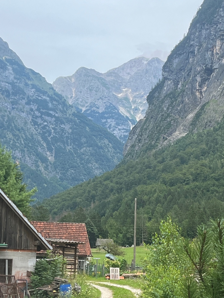
There are quite a few buildings at Egger Alm (an Alm is an Alpine pasture) and, unlike a lot of the alms, it is accessable by car, but it still felt quite remote. Yesterday I mentioned that the place we were staying in only accepted bookings by telephone and I spotted that the telephone in question was an old brick Nokia, attached to a large aerial.
We had made the rookie Alpine walking error of running out of cash. Nowhere accepts cards and, although we had enough for accommodation, there was no post-walk beer for us yesterday. What a wilderness!
We had an early breakfast and were walking by 6.30am.

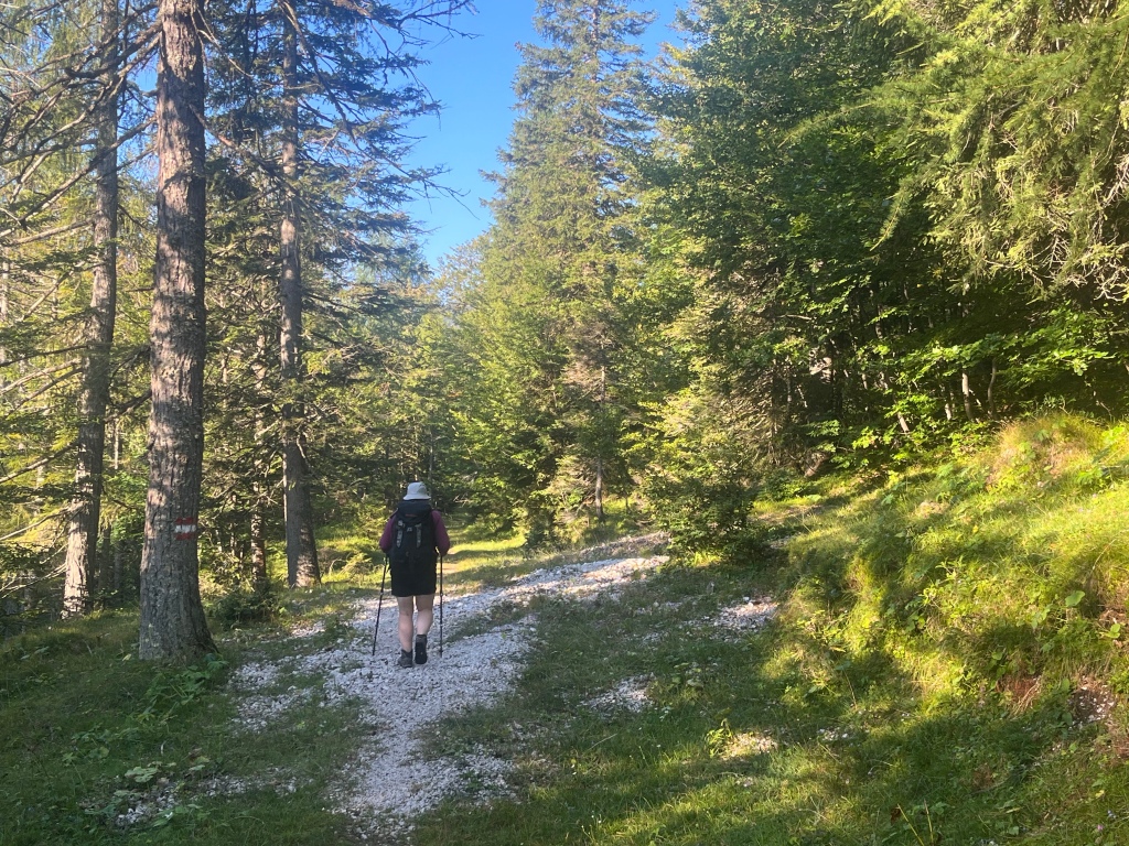
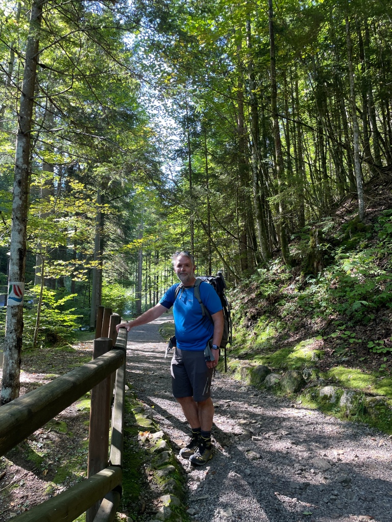
The first part of the walk was easy walking on drivable forest tracks.

That changed when we crossed the border into Italy, where what we were following was apparently an old military path.
It was rather more crumbly than the Austrian path. Sometimes it was really very crumbly requiring a cautious approach.

Once back into Austria though life got much easier again.

Actually the path did get steep and rough, with the occasional artificial metal step and wire to pull on, which spoiled the ‘walking in Austria is easier than in Italy’ narrative. It was less crumbly though.
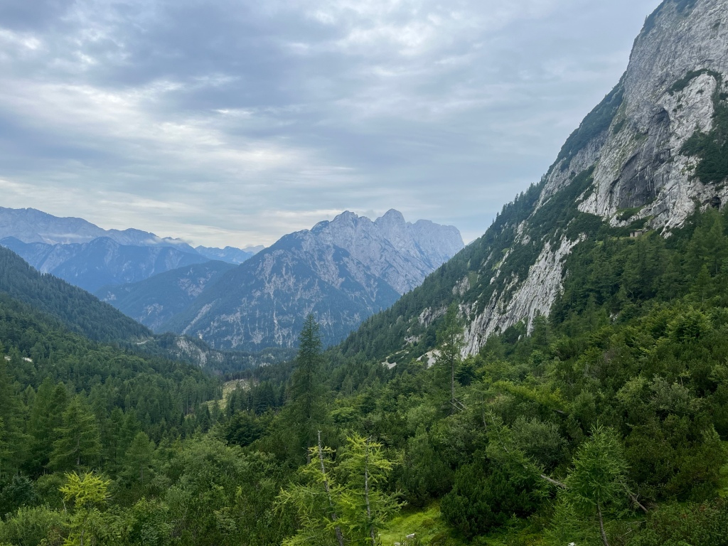
The terrain was changing, becoming less forest and more mountainous.


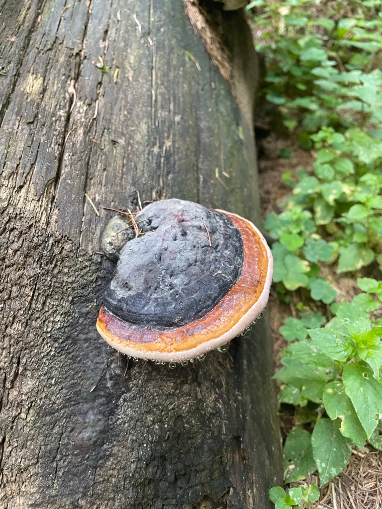
We were leaving the forest having failed to see a bear (apparently there are bears). We did see millions of ants and enormous ant hills, but that wasn’t much compensation. Eventually we came to the ski paraphernalia of the Nassfeld ski resort and after a stiff climb to a col, Nassfeld appeared below us. There was going to be a cash machine there.

We have walked about the same distance as we walked yesterday, but it looks much further on the map, which must be because at least some of today’s walk was in the right direction.
Nassfeld was chosen as our finishing point, because it is possible to get here by public transport (I’m not sure that’s the right way to describe it) and so we can make our way back here to continue next year. Having finished this section we have made our way back to Villach by chairlift and gondola to Tropolach (glad we didn’t have to walk down there), bus to Hermagor, and train to Villach (this time our stay here was part of the original plan, and doesn’t seem to involve lederhosen). On the train I was able to add the photographs to the last couple of days.
I’m not sure it is going to be possible to publish this today because of lack of phone reception. I’ll certainly have to add the pictures later.
We liked the refugio very much. It was very quiet and friendly. There were dormitories but they were small with 4 beds, and we had one for ourselves.
Judith had wanted some Apple Strudel last night, but apparently it wasn’t ready, so she was given it for breakfast instead.
This landscape is very different from the Julian Alps, with forest and Alpine pasture.

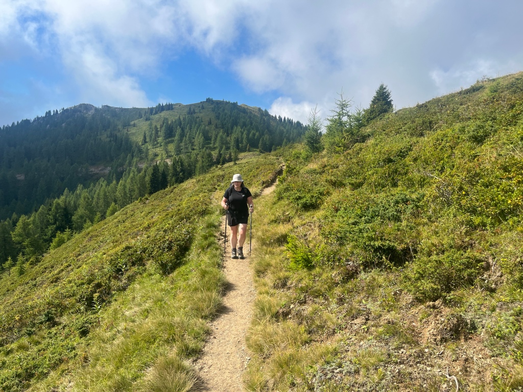
We made our way along the complex ridge. The paths were usually good, but with some steep sections.

Some of the paths were not well used and were very overgrown. At one stage it seemed as though the path might disappear altogether leaving us in steep heavily vegetated hillside with only a penknife to use as a machete.
It was usually well marked, but we did have to use map and GPS quite a bit.


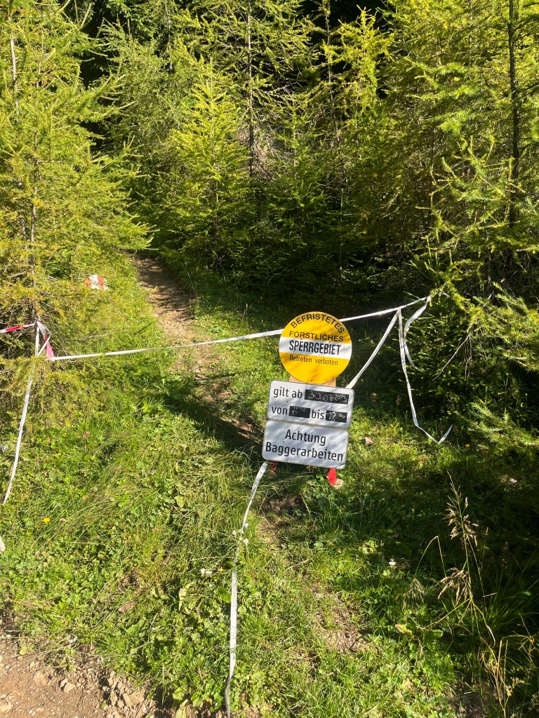
At one point the path said it was closed due to forestry works. With no viable alternative route, we took the risk of being shouted at (either in Italian or German) but in the end passed through the area without incident. We had heard about this at the hut last night so know we weren’t the only ones to take this approach. We at least could have played the stupid foreigner card.
Language is much more difficult here than it was in Slovenia, where everyone spoke English. Here both Italian and German are spoken but not much English. The place we are staying tonight would only accept bookings by telephone which proved very difficult. In the end I emailed the tourist office in Hermagor and they booked beds for us.
Another scorching day, but we managed to do most of the hard work in the morning, and have drink plenty of water.
I’m going to have to add pictures later because there isn’t enough internet here.
We were treated to another festival last night- Alpenfest or something like that. There was a big parade, but thankfully no expectation that the general public would wear lederhosen. For some reason there also seemed to be a celebration of 90s disco music.


Judith says I only need two words for today’s blog- hot and hilly. But I also feel the need to say that hilly was largely of the upwards variety.
In fact the day didn’t start hilly at all, with a 3 mile walk along the valley to Camperossa. From there it was necessary to make amends for yesterday’s flatness with a steep ascent of a bit more than 1000m (or, using our preferred unit of measurement, slightly more than a Scafell Pike). This was mainly in trees, but even so, it was extremely hot, and was quite draining.


Eventually we got to the broad ridge, which is the Italian/ Austrian border, and we came out of the trees into a delightful Alpine landscape. It was even quite flat for a while.


Then more steep uphill took us to Friestritzer Alm, which was very busy. So far we hadn’t met very many people, so I suspect this was more accessible than the way we had come might suggest. This high pasture, which apparently has been inhabited since the 18th century (summer only I suspect), even had a place where we could buy the ancient mountain medicine- Coca Cola. This revived us for the last short section of the walk, which was unexpectedly all downhill, to the Rifugio Nordio. Having crossed the border numerous times, we have ended up back in Italy. The Rifugio is brand new, and this evening is pleasantly quiet.

Finally we are doing what we planned to do in the first place.
The suggested Via Alpina route headed off into Austria, but I couldn’t find suitable accommodation along that section, so we have followed the well- marked Alpe Adria trail to Tarvisio in Italy.
For the most part our walk was along a well made cycle path, initially through meadows of wild flowers.

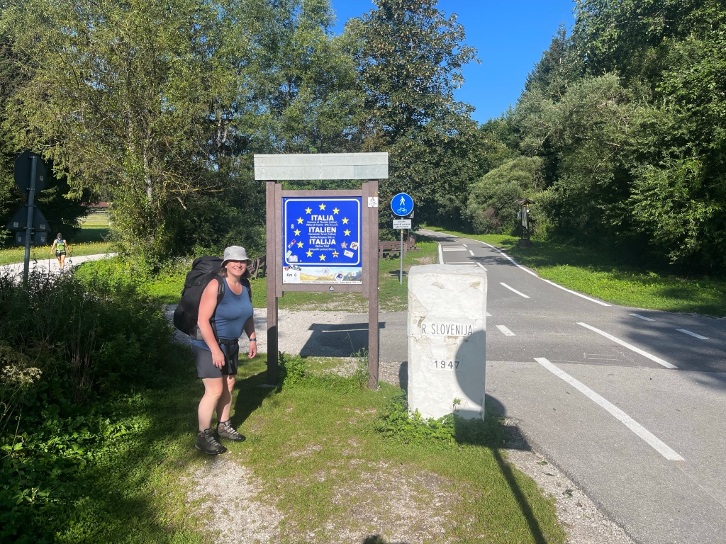
And soon we crossed into Italy.
We could have followed the cycle path the whole way, but we took a diversion to visit Lago di Fusine. This is a popular tourist destination and the path was a lot easier than some we have walked on. It even had a bannister.
The lake was well worth visiting, and allowed a look back at the Slovenian mountains we were leaving behind us.

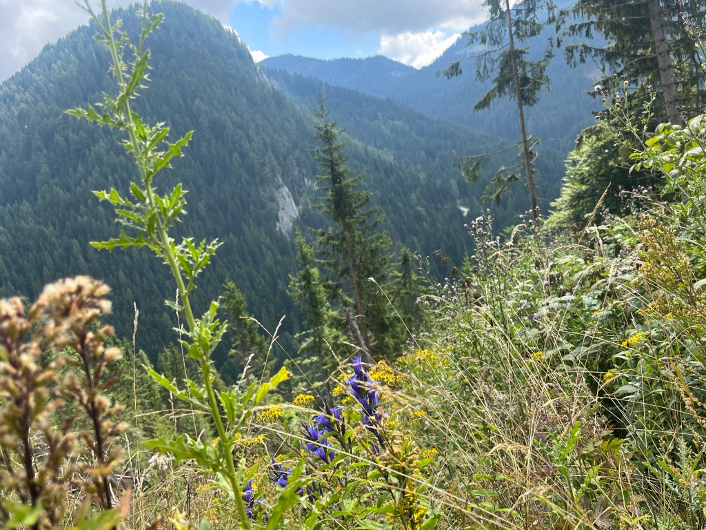
The descent from the lake was through woods, with all sorts of flora and fauna.


The occasional clearing gave a view ahead…

Or a view back to the Julian Alps.
After a while we rejoined the popular cycle track, which took us the rest of the way. It followed a disused railway and made for very easy walking with no steep hills. My knees were very grateful for that after yesterday’s extra curricular shenanigans. Although more than 10 miles on tarmac was hard on the feet and by the time we arrived at Tarvisio it was very hot and we were glad to stop.

Tarvisio seems to have some sort of festival going on, but nobody is wearing lederhosen!
According to plan A this was meant to have been a day off in Kranjska Gora, as we should have been walking 6 straight days. Having been following Plan 22F, we have now been reunited with Plan A, but haven’t been walking for 6 days. So a plan emerged to climb Prisank, which towers over Kranjska Gora and is a bit of a feature from our apartment. And this was the first unambiguously fine day we’ve had, which was probably a requirement.

As it happens Judith and I have climbed this mountain before- 23 years ago. She obviously has a better memory than me and decided to sit this one out. So it was my brother, Alistair, his children Jack and Alys, Jack’s girlfriend India and me.


I remember from 23 years ago that it was quite a long a strenuous day. Guess what- it doesn’t seem to have got easier over the years. If anything it is now bigger and steeper.


The way down was hard work. Very steep and loose and it took us a long time.
The descent went on a bit and we all lost interest in photography, but eventually we reached the grass and flowers and crickets.
A magnificent day, and we are now about to have supper looking up at Prisank, which is glowing pink.
We really liked Trenta. A hamlet surrounded by enormous vertical walls disappearing into the cloud. The cloud did lift enough for Triglav (Slovenia’s highest mountain) to put in a brief appearance.
Trenta has been added to the elite list of villages we have visited on this trip that we’d like to go to again- Ceillac, Roubion and now Trenta, all quite difficult to get to. At the moment Trenta is the most likely to be revisited, as we will need to go there again if we ever actually manage to do the Julian Alps section.
In order to get back on track with the original plan, we needed to go back to Kranjska Gora. Fortunately there was a bus, which went over the Vrsic pass via a million or so hairpin bends.
We have finally met with my brother and family, the previous planned meeting being scuppered by apocalyptic weather.
Yesterday was a spectacular mountain day, but it was also, for us, quite a long one. Today was much shorter- a long descent to the village of Trenta, 1000m below us. In the original pre-flood plan, we would also have arrived here today but from the opposite direction.

It threatened to rain but remained dry while we were walking.
The descent was nearly all in forest, and not too steep.

We got to Trenta by lunchtime. It is a tiny place, completely surrounded by enormous mountains. Very attractive and dramatic.


We were able to buy some lunch in the tiny shop and eat it while the rain still held off.

Tomorrow we catch up with my brother and his family who are on holiday in Slovenia. We should have met them a few days ago, but everyone was trapped because of the storms.
Having failed to cross the Slovenian Julian Alps from south to north, we thought we should have a bit of Julian Alps experience before heading into Italy and Austria. And today certainly provided that.
We got the bus for a short ride to Rateče, from where we can pick up the trail again.
We made sure that there was going to be no repeat of the great controversy of 2021. You don’t need me to remind you that towards the end of the first day, it was discovered that Judith’s pack was actually heavier than mine. This, apparently, must never happen again.
The walk began easily heading into the Planica valley.

You can see it is nice and flat, but that enormous hunk of limestone at the head of valley needed to be crossed, and our route was going to do this by taking a surprisingly direct line.
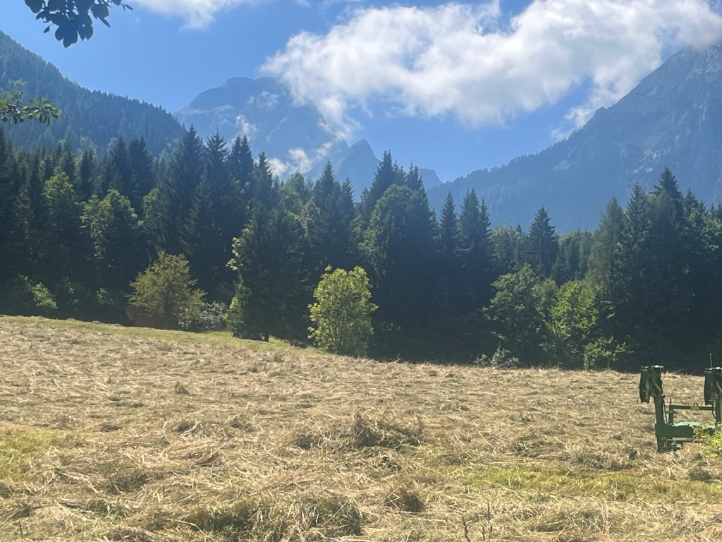
We passed lots of these, which are for drying hay (we think).

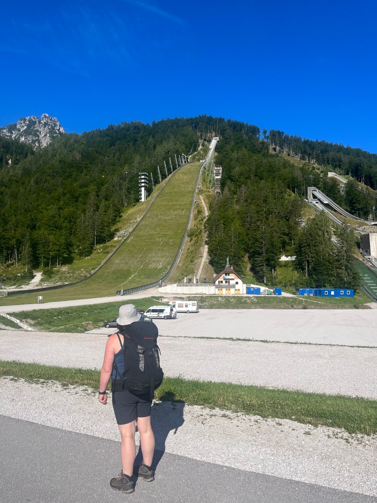
And the famous (apparently) ski jumping area.

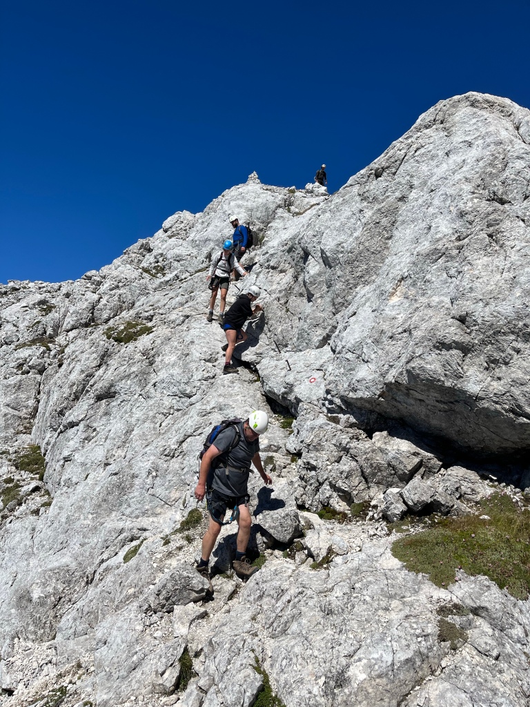
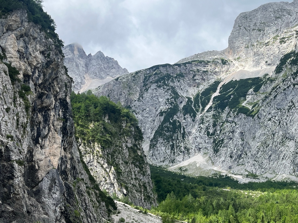
As we walked up the valley the mountains got closer, and the possibility of a route through them seemed increasingly improbable and intimidating.

In the picture above you might be able to make out a diagonal line on the cliff, bottom right to top left. This was to be our way over this massif. This ‘rake’ was steep but easier than looks suggested. We were to get there through the gorge in the centre right of the picture below.

But before that a look around the valley.


The gorge we climbed up was a chaotic jumble of boulders.
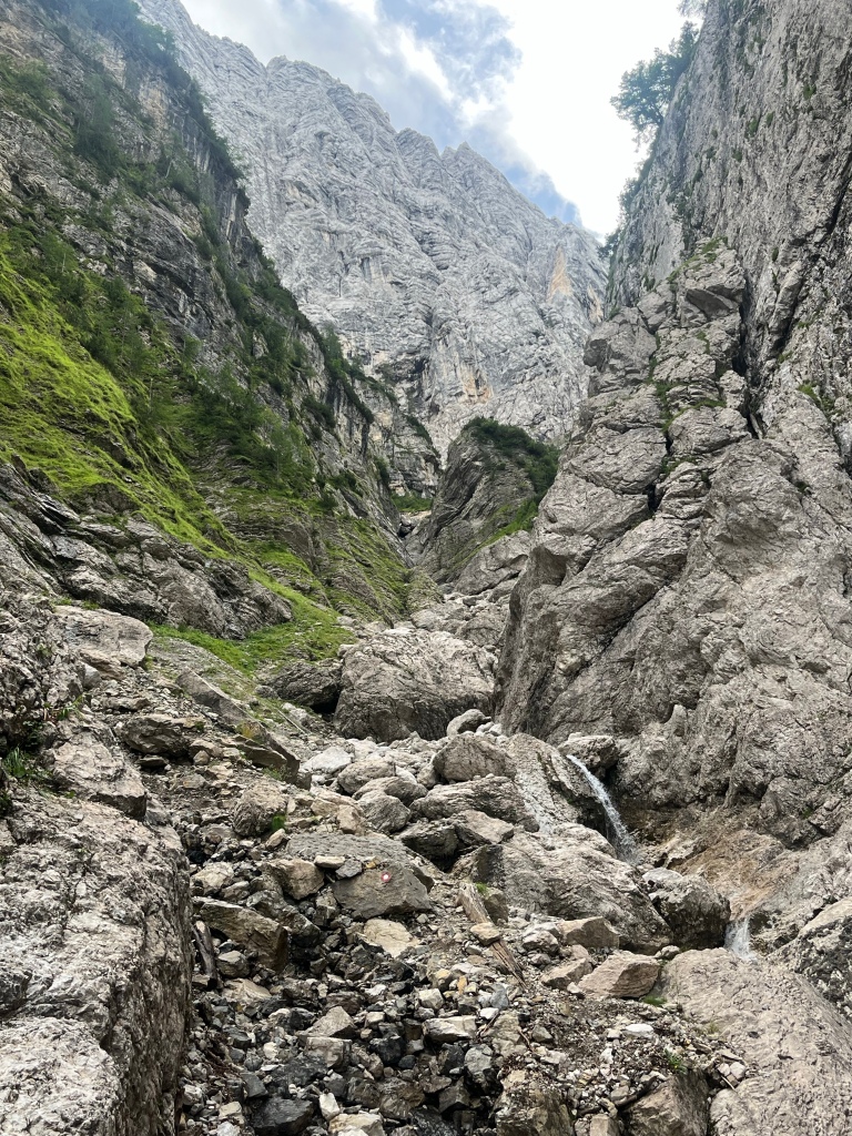
The going was made a bit harder because of the damage done by the recent storms.
Once out of the gully the going got easier.

Eventually we reached the skyline, and having seen nobody all morning, suddenly there were lots of people about. The implication of this was that our route down the other side was going to be easier and shorter than the way up had been.
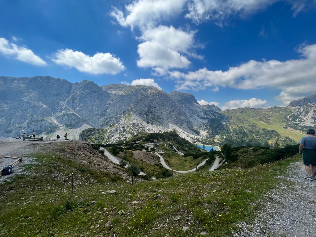
We joined the crowds to take in a summit- Slemenova Spica (1911m)

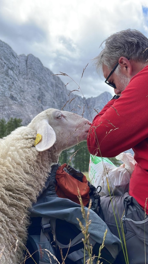
Lunch was rudely interrupted by a very persistant local.

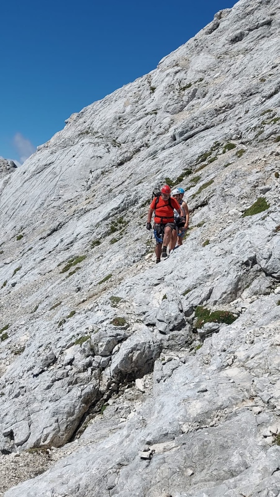
We made our way along a rough path, through beautiful Alpine scenery.

This was followed by a steep descent to the Vrsic pass, where we have some accommodation, our first mountain hut of the year. It is rather more comfortable and spacious than some, and there is even a choice of meal, so it may be possible to avoid polenta).
After a delayed start this was a very fine and memorable mountain day.
